Territorial and socio-economic diagnostics for the Intermunicipal Structural Plan of Valdisieve
Title Territorial and socio-economic diagnostics for the Intermunicipal Structural Plan of Valdisieve
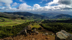
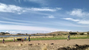
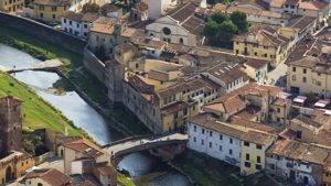
Location Municipalities of Pontassieve, Londa, San Godenzo, Rufina and Pelago (Tuscany, Italy)
Duration September 2020- June 2021
Funding Unione dei Comuni Valdisieve e Valdarno
Context
The Union of Municipalities of Valdisieve and Valdarno – formed by the municipalities of Pontassieve, Londa, San Godenzo, Rufina and Pelago – has drafted its new Intermunicipal Structural Plan, for a area-wide planning that goes beyond the borders of each municipality. This new Plan includes tools and identifies targets and objectives to promote the social and economic inclusion of the whole area in order to propose common solutions. ARCO has been involved in the project to carry out a territorial and socio-economic diagnostics as one of the starting points for the definition of the Intermunicipal Structural Plan for the definition of the Intermunicipal Structural Plan.
General Objective
The Local Development Unit has analyzed the characteristics, the performances and the criticalities of the existing socio-economic system within the territory of the Municipalities of Pontassieve, Pelago, Rufina, Londa and San Godenzo, in order to illustrate the situation (referring to the year 2020) and, at the same time, to elaborate forecasting trends relating to housing issues, manufacturing, agri-food sector and tourism.
Our contribution
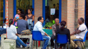
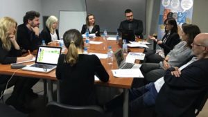
To carry out the territorial and socio-economic diagnostics Researchers adopted a mixed methods approach that involves both quantitative data – surveys on primary data and analysis of secondary data – and qualitative data – interviews and focus groups. The integration of these two techniques aimed at producing more informative, comprehensive and useful results. The research methodology was articulated in the following phases:
- Analysis of existing reports and documentation;
- Collection and systematization of demographic, social and economic information and data available for each of the five Municipalities, both at the municipal and territorial level, through a variety of indicators;
- Integration of the information framework by carrying out semi-structured interviews and online questionnaires;
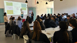
- Interaction through participatory processes and promotion of citizen active participation in the Working Tables;
- Processing of the information collected through the use of software for the analysis of qualitative data;
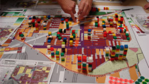
- Processing and geo-referencing of data for the construction of thematic maps.
This plurality of sources allowed to obtain a complete picture of all the social and economic aspects that will be addressed in the future inter-municipal planning and the enhancement and protection of the territory and social cohesion.
Read more on our Local Development Unit
Related Projects
-

Betting on the Future: Youth and Territory in the Empolese Valdelsa Municipalities
-
Generation 2030 training for local authorities on youth participation for sustainable development
-
Capacity Building European Facility for the Readmission of Migrants – EURCAP, Final Evaluation
-
Voluntary Local Review of the Metropolitan City of Rome
-

Evaluation of Dare to Hope, a project to create socio-economic alternatives to migration in Nigeria
-
Territorial analysis for the recovery of the historic village of Villa Saletta
-
Territorial analysis for the enhancement of the Medici Gardens of Pratolino
-
Studies and research for the eco-sustainable recovery, renovation and functionalization of the Villa Mondeggi Estate
-
RESTART MED! capitalisation for the promotion of sustainable tourism in the Mediterranean
-
Evaluation of the project that fosters mainstreaming migration into international cooperation and development policies
-

Evaluation of the project INside AUT promoting the autonomy of persons holding international protection
-
SDGs Localisation Strategies and Local Development in Tunisia
-

The Localization of the SDGs and post-pandemic recovery through enhanced multilevel governance
-

Migration and the localisation of SDGs: the role of diaspora associations for sustainable development
-
Final evaluation of the IOM project on municipalities and migration mainstreaming in Italy and Albania
-
Territorial analysis for the valorisation strategy of Atelier Marco Bagnoli and the association Spazio X Tempo
-
Mid-term evaluation of the MED GAIMS project for tourism promotion and preservation of cultural heritage in the Mediterranean
-

Territorial and socio-economic diagnostics for the Intermunicipal Structural Plan of Valdisieve
-
Evaluation of the CROSSDEV project to promote sustainable tourism in the Mediterranean
-

The Tuscan System of International Cooperation for the 2030 Agenda for Sustainable Development
-
SDGs Localization for the 2030 Agenda for Sustainable Development for the Metropolitan City of Florence
-
Development of sustainable tourism to preserve and enhance the Romanesque cultural heritage in Tuscany with Itinera +
-

SDGs localization to design sustainable development strategies | ARCO
-
Mid-term evaluation of the project to contrast irregular migration in Ethiopia
-

Evaluation of the SPRAR projects managed by ARCI Toscana
-
ECO.COM: strengthening local economic development in Bolivia
-
Cycle: il progetto per integrare l’economia circolare nella formazione per adulti
-
Need assessment to foster social inclusion in Tuscany
-

RB Tex: the new ethical label for the textile industry
-

Investigating the link between migration and development in Italy
-
Action-research for ecotourism development in Armenia
-
Increasing the sustainability of the local handicraft sector in Bethlehem
-
Strategic Plan of the Metropolitan City of Florence 2030
-
Impact evaluation of coffee cooperative in the Dominican Republic